The Quarry and the Years of Growth (as always, click top pic for high-res gallery)
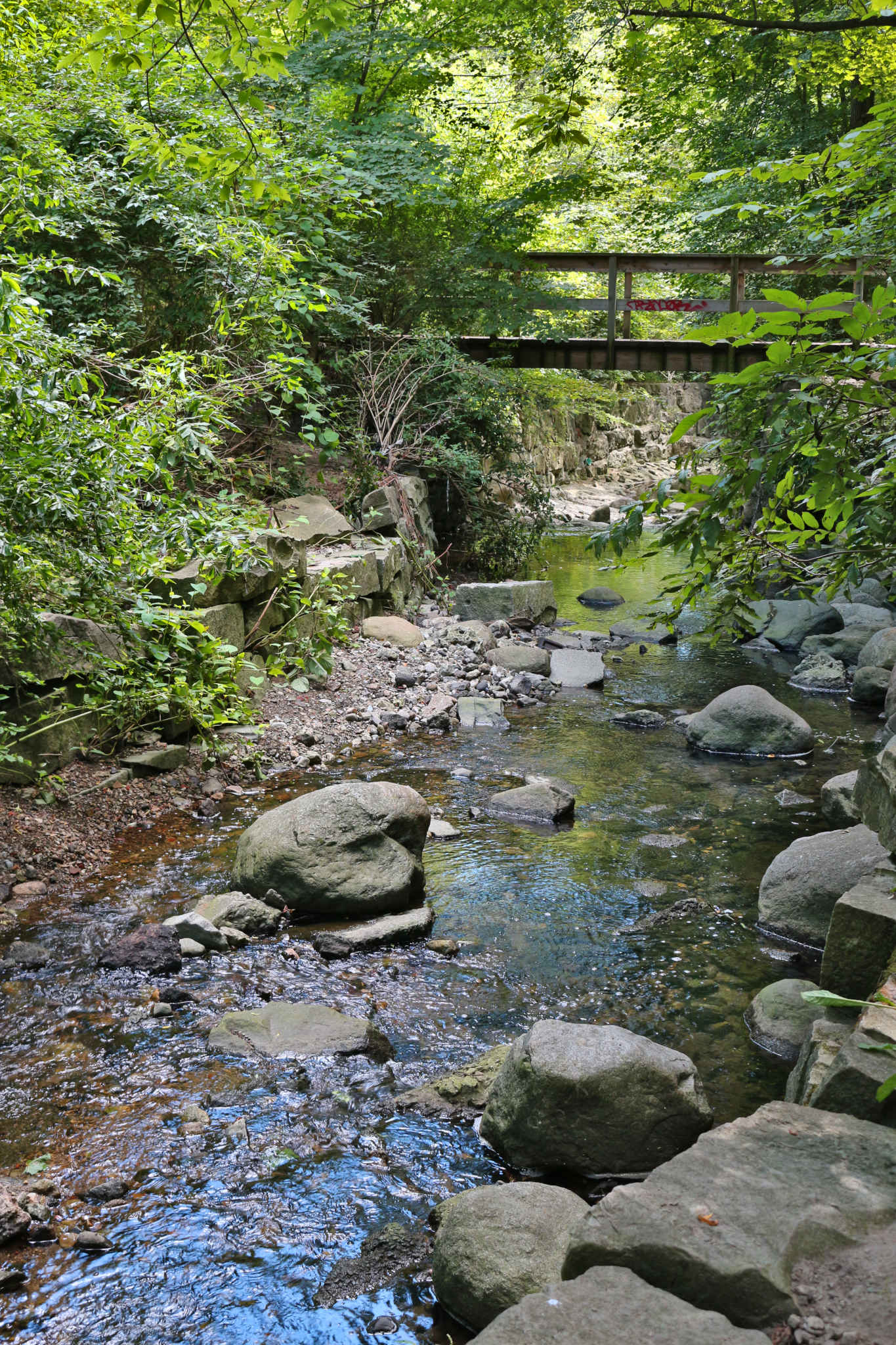
Yellow Creek may be mediated by stone – but nature works with what it finds
Like many of my photographically inclined friends around the world, I’ve been frustrated by the long confinement, though I remain fully committed to all precautions which can help reduce everyone’s risk. My long time readers will know that while I adore nature, I am a thoroughly urban creature. But in this case, my walking friend suggested an inspired route combining both in a really lovely way. It is much too easy to forget about this downtown wealth!
I’ve been fascinated for years by the watersheds of Toronto, but it’s only recently that I realized our city is unusual in having left so many of them intact, not only for their drainage benefit (which is considerable, and may prove very helpful as the atmosphere gets hotter, and thus capable of lifting more water), but also as wild parklands for city people to enjoy some of what is now rather sweetly called forest bathing. The canoe and cargo-boat navigable Humber, Don and Rouge were incredibly important for early trade, but many smaller tributaries still stripe the town with pleasingly unmanicured and fun to explore green-space.
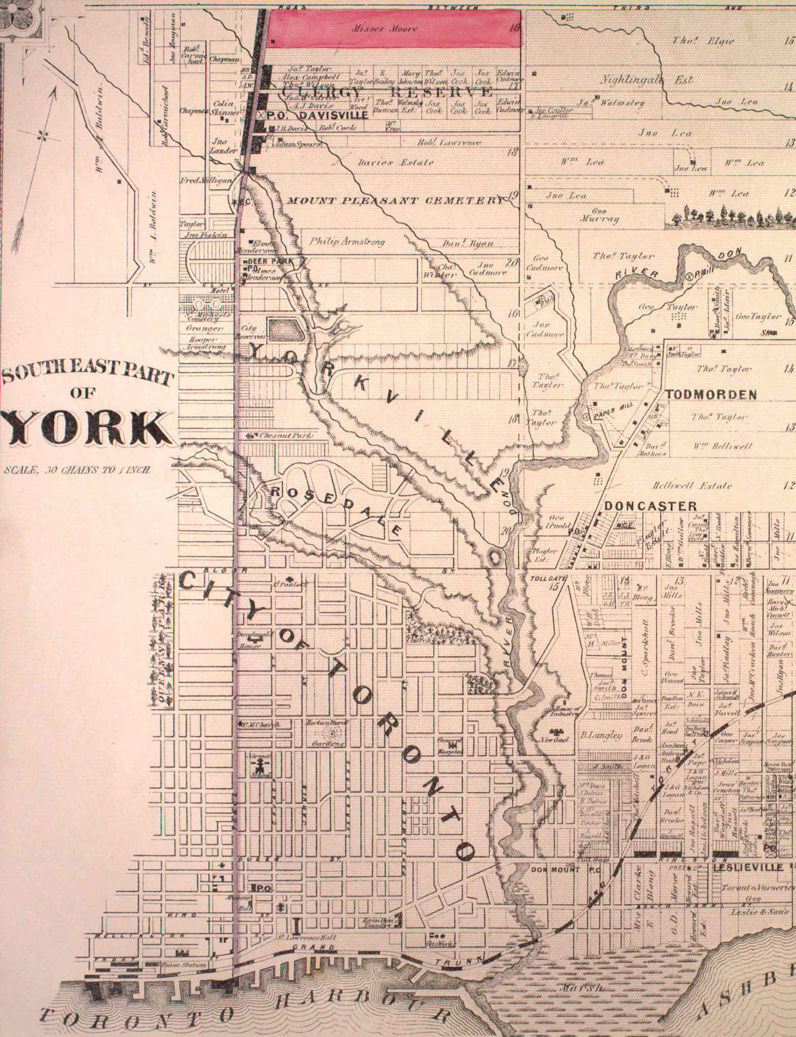
1878 Illustrated Historical Atlas of the County of York – South East Region – Excerpt
Thanks to the very impressive work of Nathan Ng, I found exactly what I was looking for – an 1878 map of my own neighbourhood, which even indicates the recently completed Rosehill Reservoir – which is the city’s oldest (1873) and largest (Originally 40, now 33 Million gallons), and must have been a hydraulic gift to the lower city, because of the escarpment elevation of the ancient (glacier days) shoreline that many Toronto people think of as “The St Clair hill”.
Our walk started very near the “Deer Park” markings on this map, and wound down the Yellow Creek ravine past the dark oblong “City Reservoir” to the section just above “Rosedale” then back up to “Mount Pleasant Cemetery” – all surprisingly old and enduring names. We live in what was then the Lauder estate (which is perfect, since Harry Lauder was Catherine’s mom Helen’s favourite singer in the world by leagues).

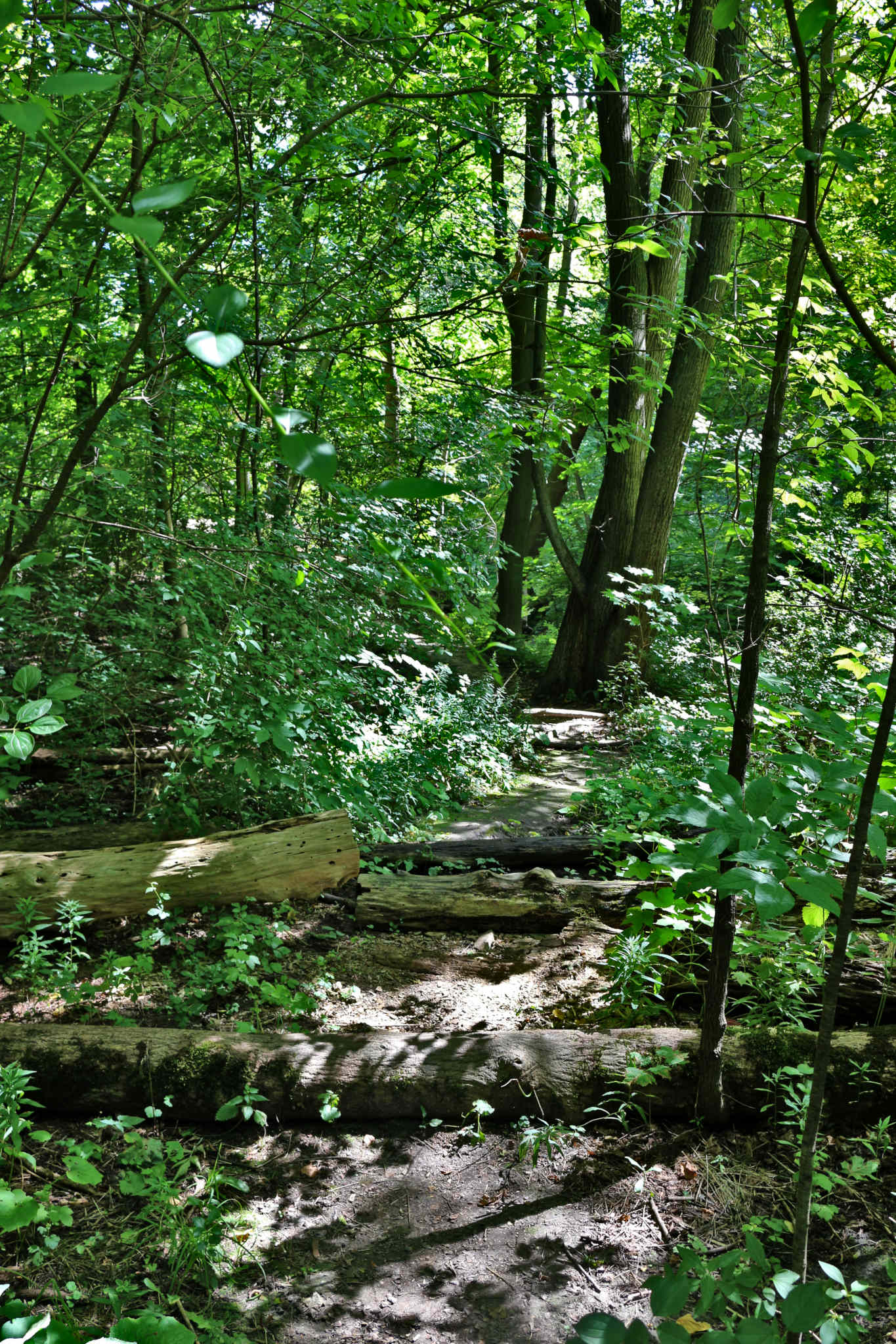
Bring Your Own Nimbility (I love kid-made short-cuts)
There are several ways into the Yellow Creek Ravine which ultimately contributes to what was in those days always called “The River Don” (even when they were saying the Humber River, and the Rouge River). We used a very long and appealingly leafy wooden staircase descent right at the Eastern edge of Heath, and then exited by spending awhile walking around Mount Pleasant, trying to figure out which twisty strolling avenue lead one to the gate (they really did do a marvellous job of landscaping that cemetery for pleasant and city-excluding views, but it makes navigating the place surprisingly confusing sometimes, even for locals! There is also a blockaded but smoothly paved ramp leading down (for very rare service vehicles) from right next to the reservoir at David Balfour Park. Skateboarders have already taken note of this (and one suspects, insurance agents had conniptions in direct proportion). I’m going to have a look next time, to see if it looks like a slope that a scooter could handle without frying the brakes. It’ll be awhile before Catherine can handle the long blunt and uneven wood and dirt steps, but if she gets a mini-vehicle, this would be an ideal destination for a bit of peace (and photography).
Terrace and Dam (the Beaver teaches much)
Zooming out on downtown Toronto we can see that even the largest of the lost and mostly buried watercourses – Garrison Creek and Taddle Creek (and was it Rosedale or Cedarvale Creek, which Ramsden Park connects?), left trails of parks and pleasant ravines in their passing. But the many which remain waterful are especially fun.
Of course, they also speak to us about the force of time in a way that to-the-minute city people very rarely slow down enough to appreciate. Yellow Creek does have a nearby friend, Mud creek, which helps to feed the lovely Don Valley Brickworks park (worth a visit for curious adults or whole families – cool history and great markets).
While the budget for their original (inspiringly ambitious) environmental innovation and proving complex fell through, there are still many excellent demonstration projects dedicated to rewilding overly controlled rivers to recover wetlands as key nature refuge and urban flood-sink both. Lots of wee animals – bring a long lens!
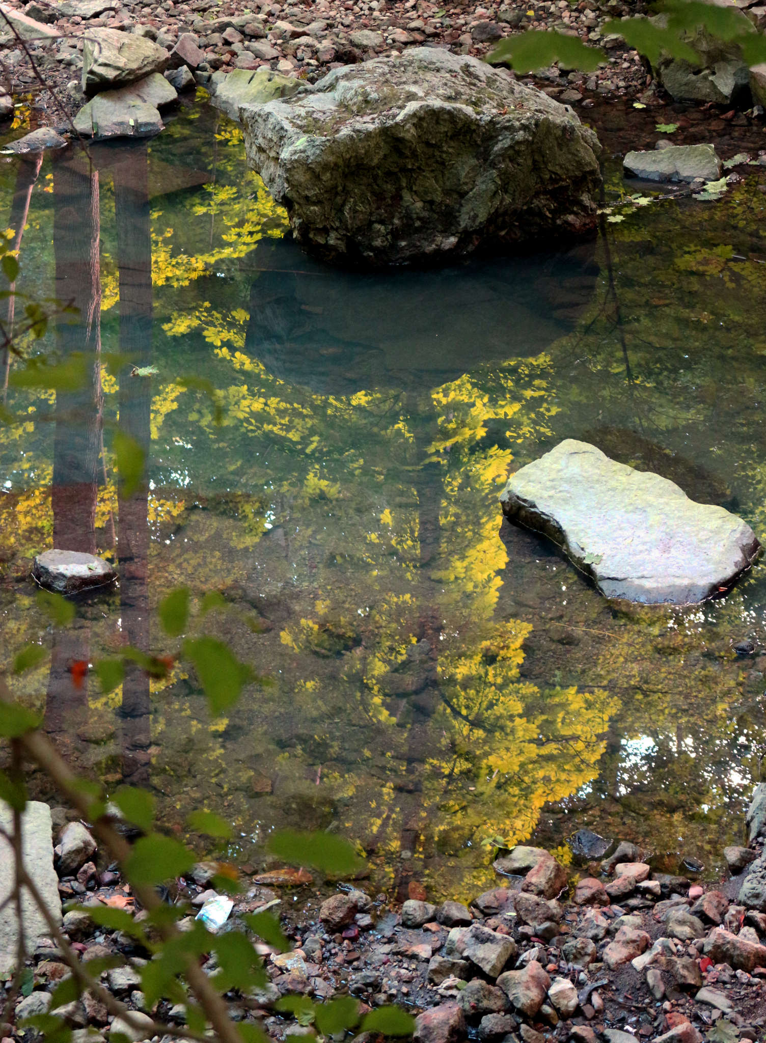
Rock Tree
But though Mud Creek is near and its Moore Park ravine drains more water, Yellow Creek has still created a very impressive ravine, and without the heavy stones added to key turns and the slowing runs to address erosion, one suspects it would still swallow a (very expensive) house, every year or two, during a heavy rain event.
Gathering Tribut(aries)
How many years, to contour the land so much? Hard to imagine, but it was certainly started long before the first people were here, and long before the arrogant buggers came from overseas to hassle them and mess with the place, too! Funny how, much like the Greeks with their sacred (and yet slave powered) democracy, those great minds of the “Enlightenment” were as yet incapable of recognizing alternate enlightenment already achieved here. Though one must give them some credit – the basic model of American Democracy (trumpets!) actually comes from the Iroquois Confederacy, an impressively effective form of (for them, consensus) governance.

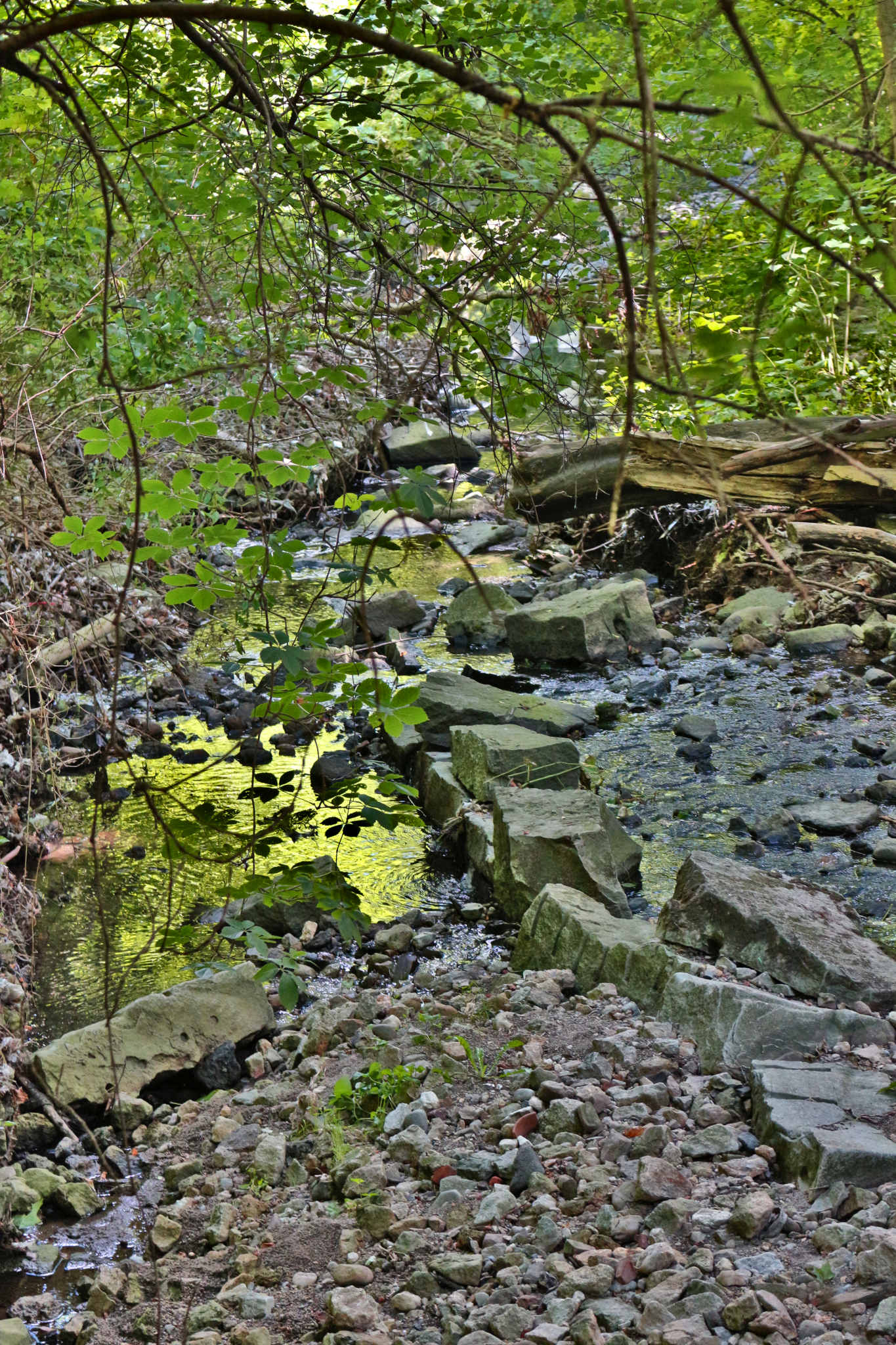
Two Lane Causeway
I suppose the Greeks were easier to credit, when the first inhabitants here were being systematically robbed, dispossessed and brainwashed by force, by the righteous (and in this case utterly and viciously insane) state. But the fact remains for those who peruse the documents.
These ravines are also good places for thinking about what the land once was, and the way it was treated by a group of cultures not hell-bent on transformation of, but instead cooperation with the environment (a lesson we might have learned centuries ago, had we but eyes to see – and a whole lot fewer goddamned Orangemen!)

This Is How We Do It
Not near the city, but of the city, all through the city, right across the city – and beloved by many quiet wanderers seeking refuge from the seamless wall of concrete and the hectoring crowds. Coolest thing of all? We didn’t see a single garbage can on our walk – or a single piece of garbage!
Sometimes being known for being overly polite (to an empirical fault, I’m sorry) really is entirely cool!
¯\_(ツ)_/¯
Check out Nathan Ng’s website Historical Maps of Toronto (a fantastic and well-organized resource).
A genuine contribution for scholars, and a glee-worthy present to urban history buffs. Thanks Nathan!